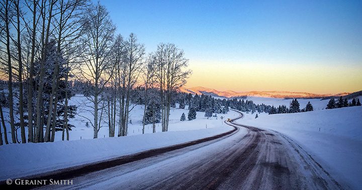
The Road To …
The Road To … “Up in this air you breathed easily, drawing in a vital assurance and lightness of heart. In the highlands you woke up in the morning and thought: Here I am, where I ought to be.” Izak Dinesen
Thanks for looking. G
Fine Art Images from the American Southwest
505-501-4880
The Road To … “Up in this air you breathed easily, drawing in a vital assurance and lightness of heart. In the highlands you woke up in the morning and thought: Here I am, where I ought to be.” Izak Dinesen
Thanks for looking. G
Backroads, off Highway 64, near Hopewell Lake, northern New Mexico. As the rain didn’t come to us, we went to the rain. It was heavy through the mountains and torrential heading north to Chama, NM. When we pulled off the highway and drove down this road I was wishing I had brought the single malt. All we were missing besides was the heather. Thanks for looking. G
Highway lightning strike, on the Hondo Mesa, Taos NM. Right now it feels a bit like Wales on the mesa. This system brought a lot of rain, a real good ground soaking rain. Thanks for looking. G
Lama road (Old Highway 3) burn area from the Hondo Fire 1996. I wanted to share this image from the area north of San Cristobal, in order to show the damage done 22 years ago and how looks today. I made a series of very large panoramas depicting the regrowth in the burn area. I find the area hauntingly beautiful and I will share more images from this series. As you may have heard, the fire season is upon us, and here is a gentle reminder. Thanks for looking. G
Windmill on the Rio Chama Road to Christ in the Desert Monastery. I’ve spent many summers camping near here with the kids, and made numerous photo tours on the Chama River over the years. I remember when the windmill turned like a airplane propeller in the high winds and the water overflowed the stock tank. Now the rotor is tied off and the pump disconnected. Things change! Thanks for looking. G
Highway sky. Heading south in to Taos, NM on highway 522, the sunset casts an eerie twilight glow over the mesa roadway and reflects off the cloud poised over the Sangre de Cristo foothills. The sun setting behind and through the fire smoke, filtering the light from the west, created this effect. I like the look of the image but the smoke in the atmosphere is getting tiresome. Thanks for checking in. G
The Rio Grande Gorge Bridge road, US Highway 64 heads east through Taos, NM from Teec Nos Pos, Arizona to the Outer Banks, North Carolina. At this point, in the above image, US 64 crosses 600 feet above the Rio Grande Gorge over the “high bridge” as it is known locally. This week’s storm clears for a few hours before the next front moves in, and spring turns to winter for the third time in as many days. A double photo op ensued. The fog lifted, followed again, by sinking heavily into the canyon like ethereal waterfalls and just in case we didn’t get the image the first time, the fog rose once more and dissipated. Here’s the image from the road bed. Next stop N.C. Thanks for looking. G
Here’s some further reading: https://en.wikipedia.org/wiki/U.S._Route_64
Mesa Road snows across Taos Pueblo land from highway 522. It snowed again yesterday, following high temps in the sixties last week. Makes it all very interesting, especially for image making.

Greetings from San Cristobal, NM. This week, last week’s Wolf Moon rising over the Sangre de Cristo foothills, Truchas, the red barn, and snow horses.
As I mentioned last week, I was heading out to capture the wolf moon rising. The moon’s appearance lasted about ten minutes between the fast-moving clouds. I made several images during that time, and the scene below was fleeting as the sun came and went behind the clouds. I got lucky. I came away with three pictures where the elements came together. I’ll take what I can get from what presents itself.
And a close-up of when I first spotted the moon from the highway heading home.
I reworked this image for note cards and publication. Ansel Adams shot this scene in the 1950’s. A couple of months ago it was lit up with Xmas lights. You can still see some in this shat nailed to the crosses. It’s nice to its longevity at this location and longer still before Ansel made his iconic image.
You know how attached I am to this location with the red barn. Every time I visit I see more dilapidation with new spaces for the wind to pass through. It’s beginning to corkscrew but I’m confident that the gaps will prevent the building from acting like a sail on the plain!
One more image I reworked this week for note cards, prints, and publication. This image has graced many a page in local magazines. Apples are the key to getting horses to come running.
As always, thanks for looking. Have a great week. G